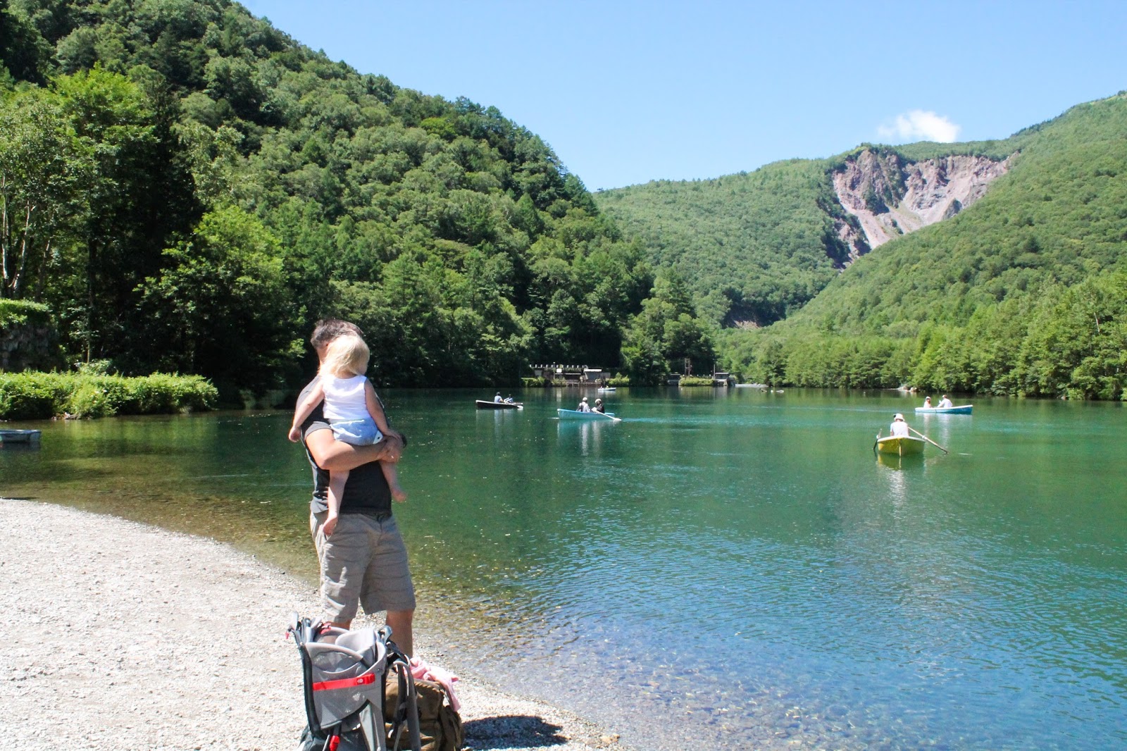
This was our favorite stop on our tour though the Japanese mountainside! We were both pleasantly surprised by how picturesque and breathtaking it was. We've already promised ourselves to come back one day without kids so we can realllly explore and enjoy the place. The whole route covers 22 miles and isn't accessible by cars. There are different modes of transportation between each stop on the route and some are kinda fun. We BARELY made it all the way to the dam at the end and literally had to run out, snap a few pictures and run back to the cable car so we didn't get stuck out there, which was kind of hilarious. I'll share more details at the bottom of this post if you are interested in going. But look at how pretty these green mountains and lakes are!!! I had almost forgotten how beautiful the mountains are. We don't get this in Okinawa!! I tried to put the pictures in order of the stops, so you can get an idea of each place.

First stop was Bijodaira. Pretty, but we just did this lame flat trail, probably my least favorite stop. Although there is a waterfall- Shomyo Falls- somewhere in the beginning here that is the tallest in Japan (350m). We just didn't have time to do everything!

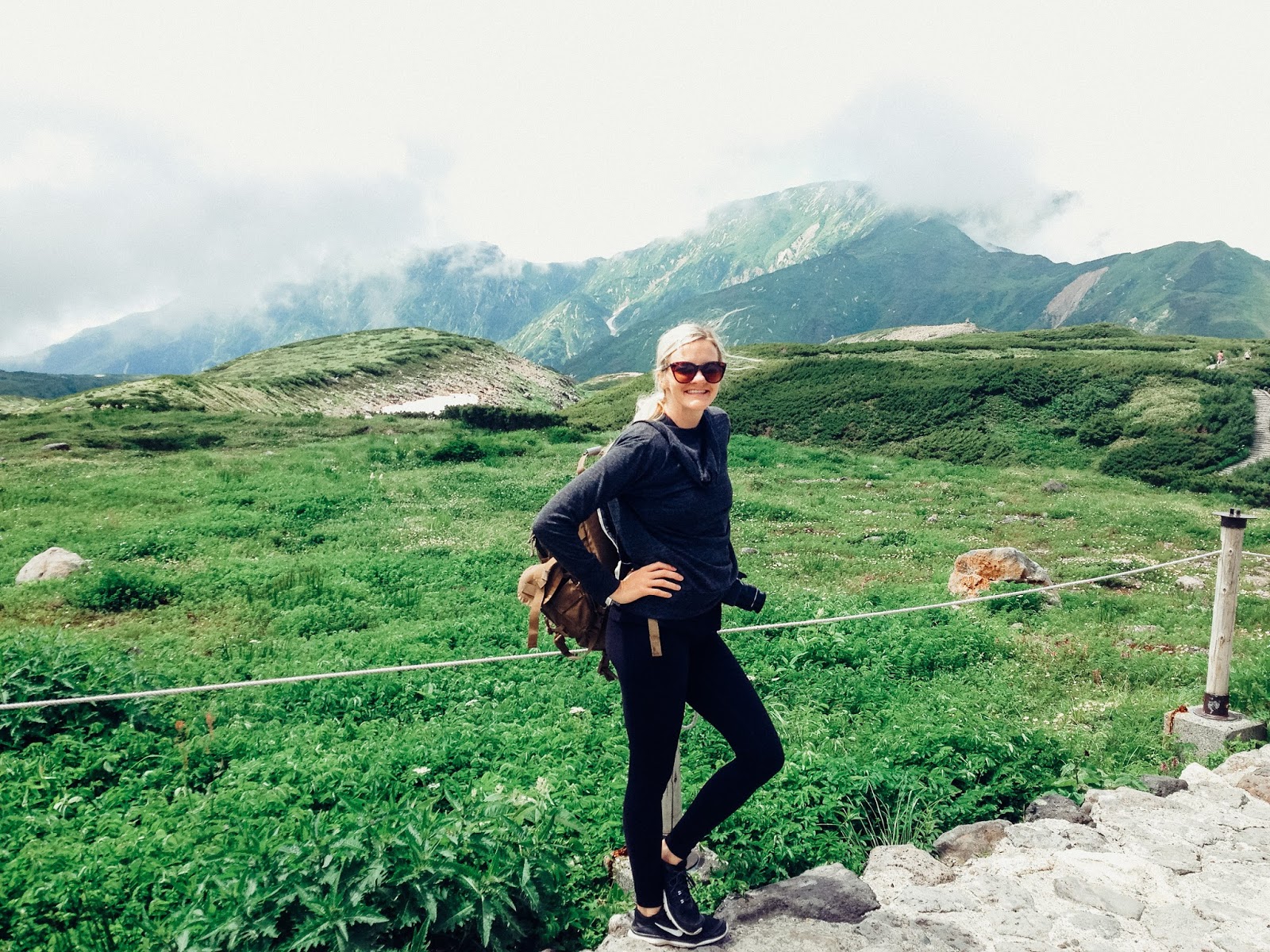
miss independent hiker


The was at the Murodo stop- I believe it's the highest point and my favorite place we stopped. We spent the most time here and could have spent the whole day or more. There were so many trails here to hike here! We were able to do about 3/4 of one trail before Lucy had a complete meltdown/tantrum and we finally had to throw in the towel and run back down the mountain. Ah, kids, gotta love them! They also had lodges to spend the night in and onsens. This is where we wanna come back to and stay in one of the fancy lodges. And hike without kids crying ;).


lunch stop

SO BEAUTIFUL!!!!


Daikanbo was a stop that was just an overlook. Unfortunately it was so overcast/cloudy/foggy we could hardly see anything!


The was the insanely beautiful ride on the ropeway between Kurobedaira to Kurobeko.


Finally made it to Kurobe Dam!


This is Japan's largest dam!


 Lucy finally crashed and it was so sweet I had to document it and post it here! There is just nothing sweeter than your little baby asleep on your shoulder.
Here's a map of all the stops:
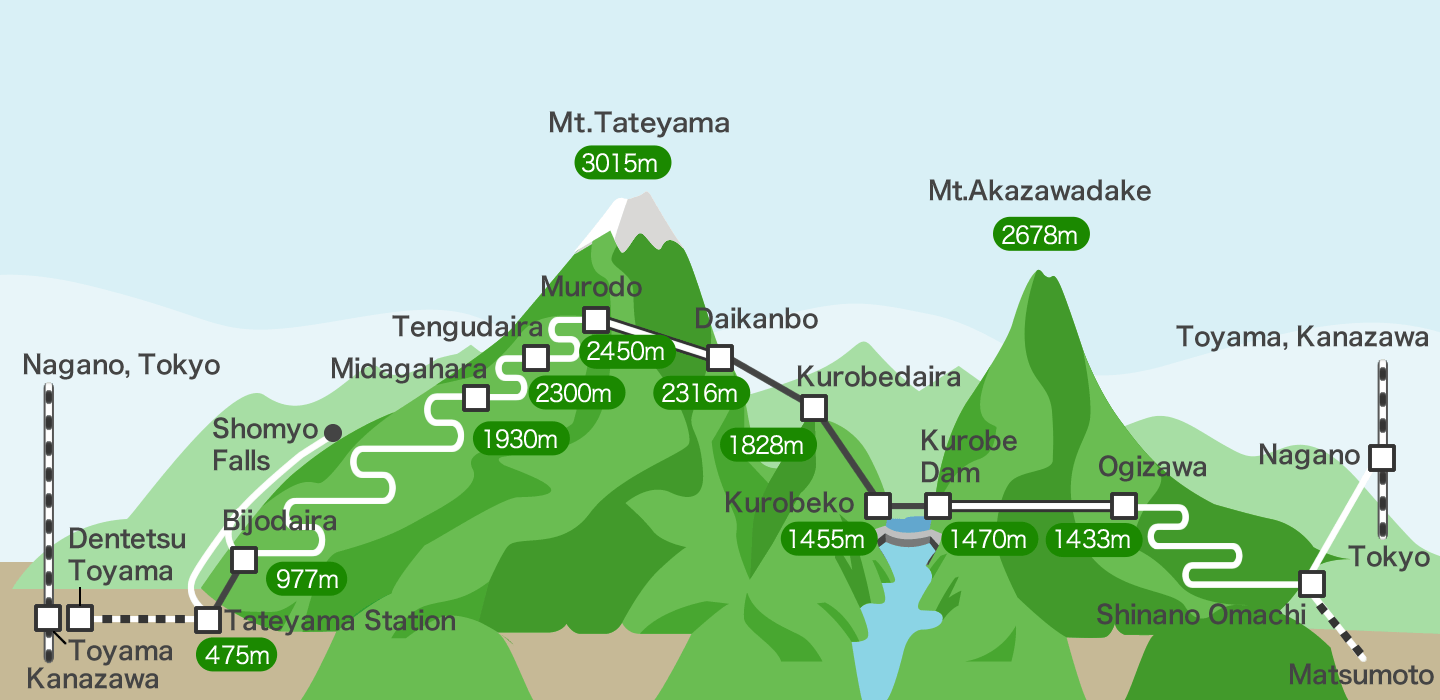
We stayed at an Airbnb in Toyama and drove to the Tateyama Station. We bought a pass to go to Kurobe Dam and back. You can start on either side and if you don't want to go back over your tracks I believe there is a luggage forwarding service. I think it took us about 6 hours to get to Kurobe dam and I felt like we were hurrying through each stop. So allow yourself plenty of time, maybe even stay overnight at one of the stops! The route is completely inaccessible Dec-mid April due to snow. However if you go from mid April to May you can see the awesome snow walls like these...

If you're wanting a taste of the mountains in the summer I'd highly recommend this place. If we hadn't booked all our hotels in advance we probably would have spent more time here.

It was beautiful guys...did I mention that? We'll be back!!